Bovilla Lake Tirana: Gamti Viewpoint & Road Tips
Bovilla Lake near Tirana: 20 km by road, gravel last stretch, Gamti balcony hike, drinking-water rules, and when a guided tour beats self-drive.
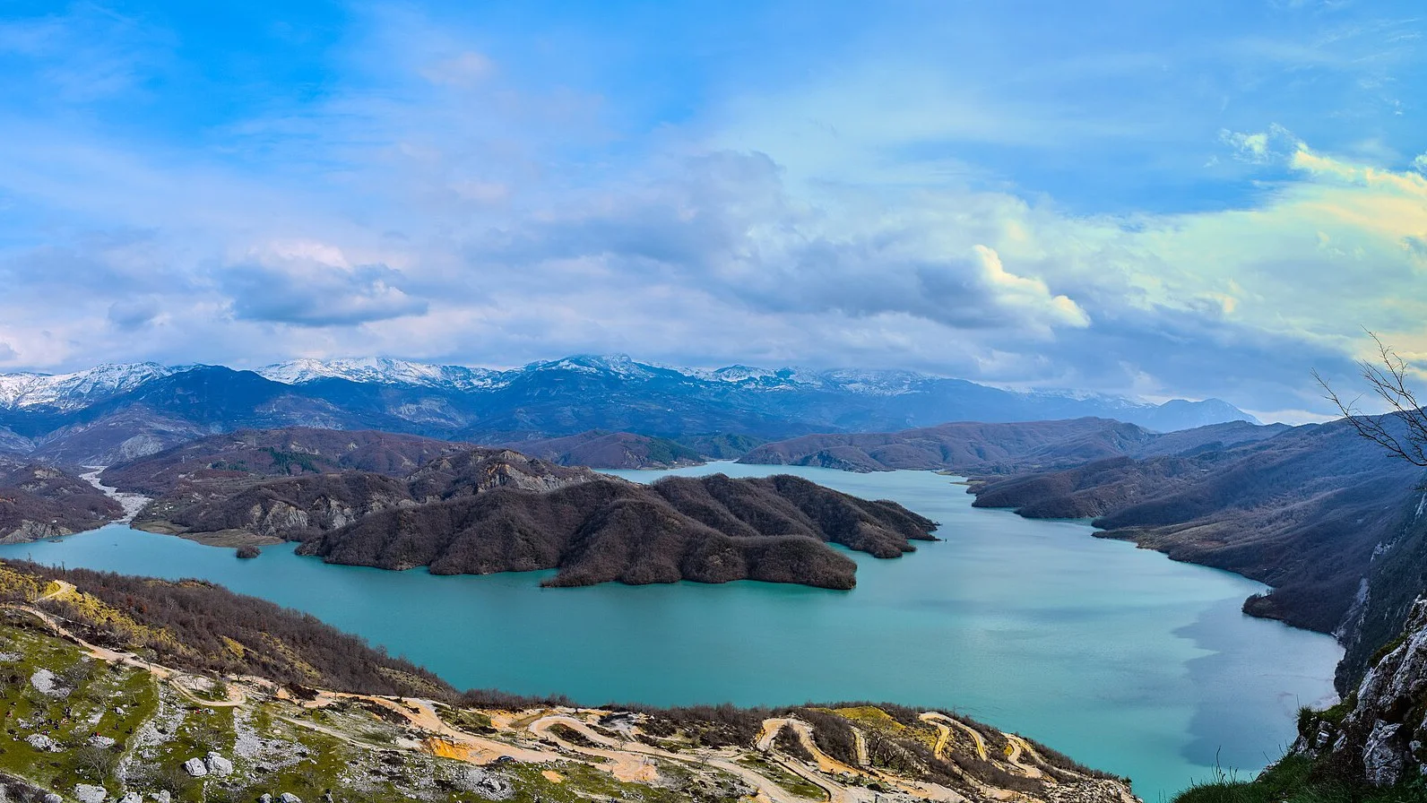
The postcard of Bovilla is not taken at the water. Stand on the shoreline and you get a pretty reservoir; climb the Gamti balcony and you get the turquoise ribbon between cliffs that fills every Tirana feed. That mismatch is the whole day.
You’ll drive about 20 km northeast out of Tirana - the municipality quotes 15 km, but that is proximity, not the route - on a road that finishes in gravel, walk a short steep path to the ledge, and look down into drinking water that supplies roughly half of the capital. Half a day, still on the Tirana clock - but treat it as the city’s tap, not a picnic beach. That one fact shapes where you stand, what you do with the water, and how you get there.
What this reservoir really is
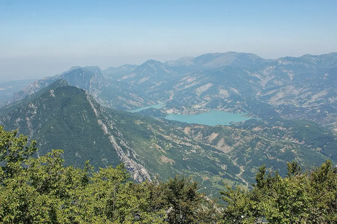
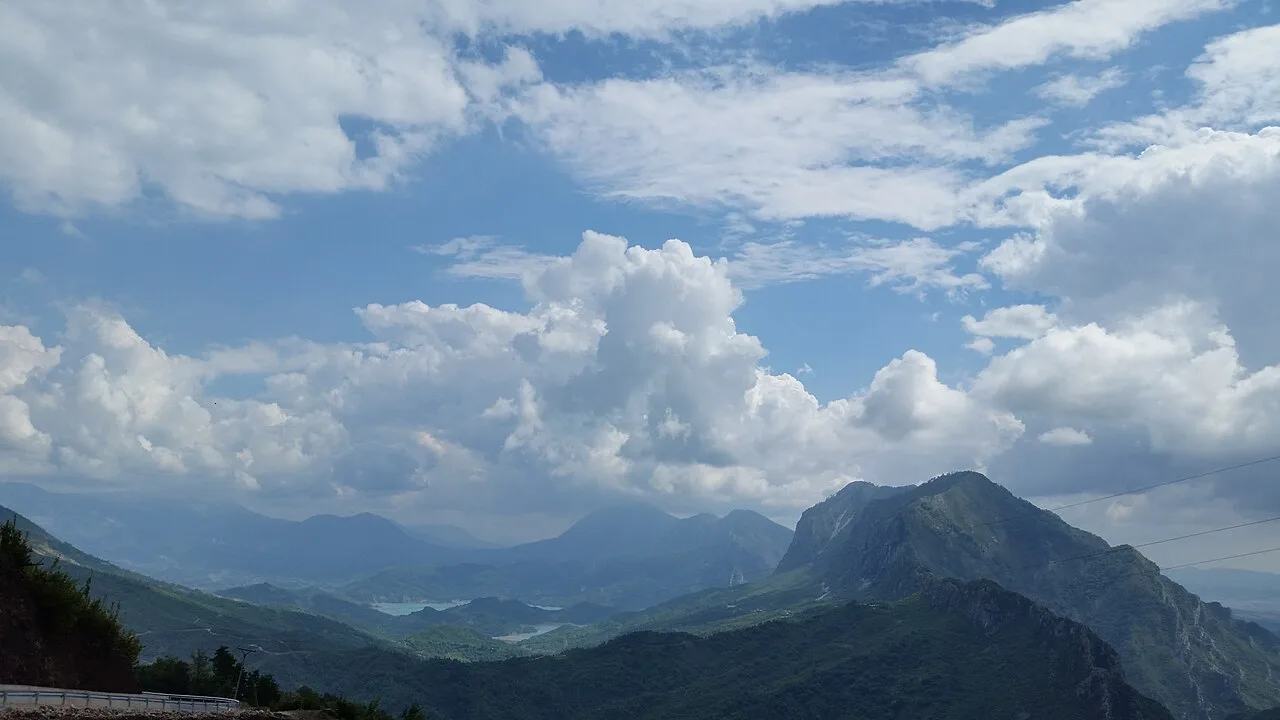
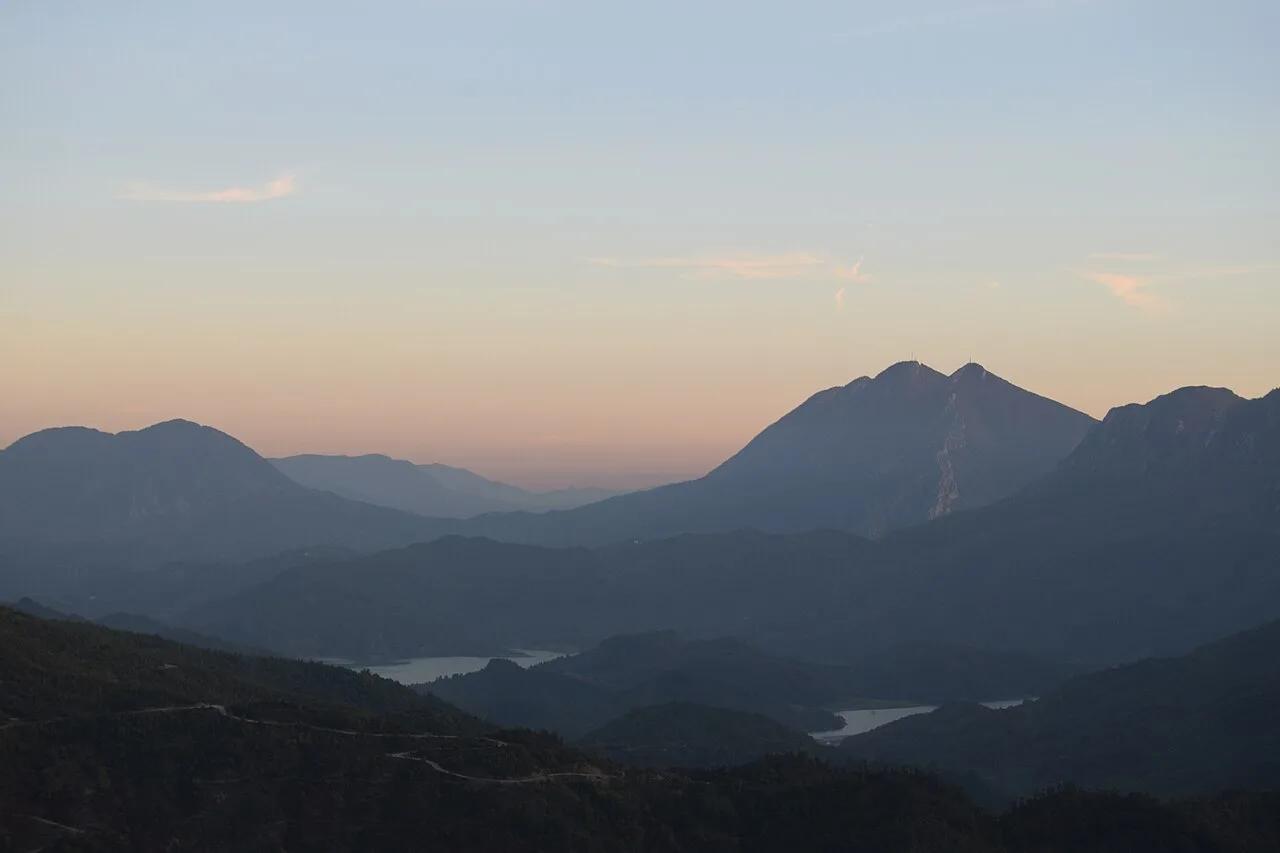
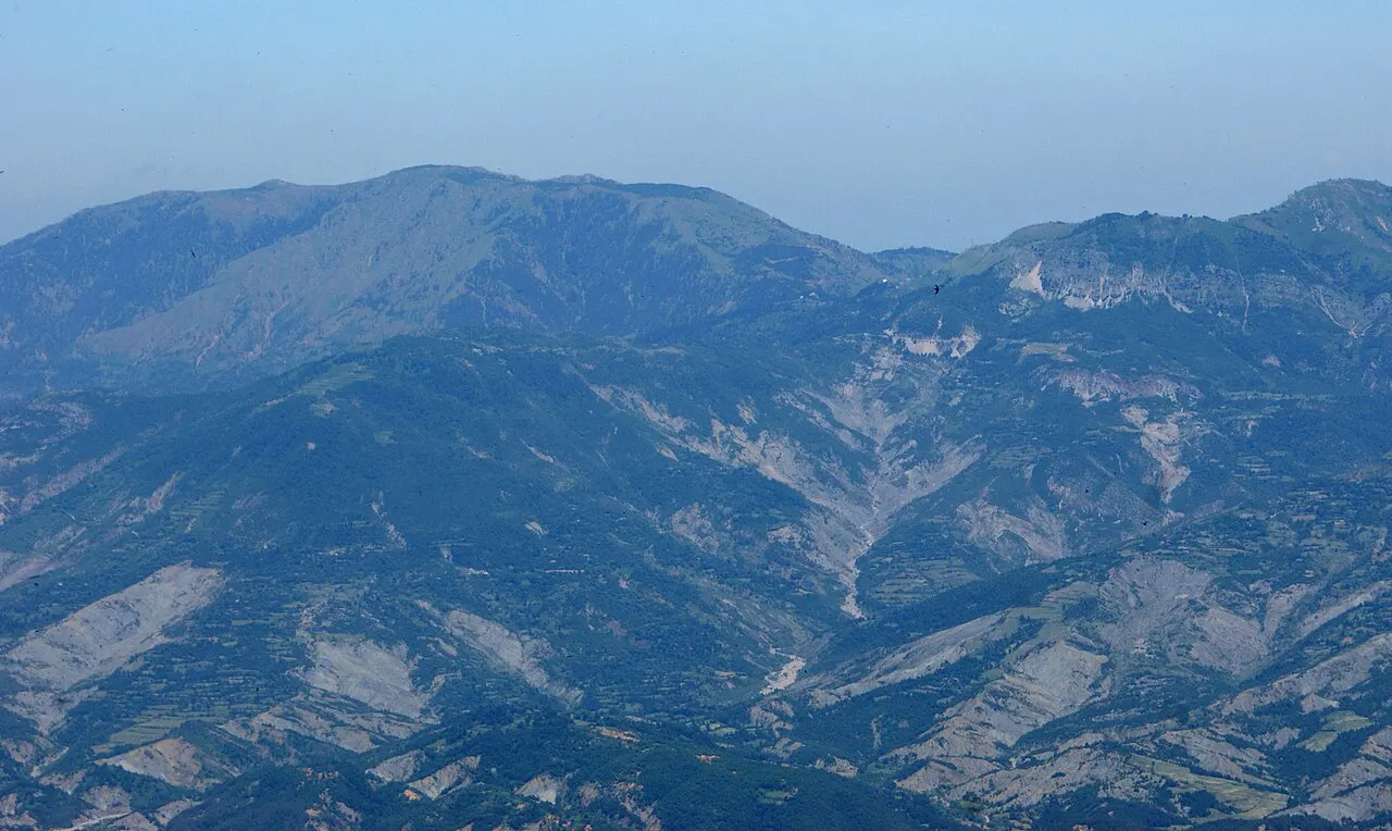
Tirana’s municipality page places Liqeni i Bovillës about 15 km northeast of the city, hemmed in by Mali i Gamtit (1,267 m) and Brari (1,214 m) to the west and Mount Dajti (1,613 m) to the southeast. The surface is about 4.6 km², with depths listed at 18-53 m. The reservoir sits inside the wider Dajti Mountain National Park area and was built by damming the Tërkuza river at the mouth of the Zall Herr gorge.
The city’s own summary puts an 81 m dam at that gorge. Engineering write-ups circulated via Wikipedia put the wall at 91 m high and 130 m long - different figures for the same structure, so treat height as approximate and don’t quote a single number as gospel without naming which source you mean. What matters for a visitor is simpler: a tall concrete-and-fill wall closing a limestone canyon, with the famous turquoise pool behind it.
Construction started in 1988, stalled when communism collapsed, resumed in October 1993 with Italian backing, and finished in 1996. The basin took until 1998 to fill. A limnological study later notes that treated water began reaching Tirana in 1999 through the Kodra e Kuqe plant and a steel pressure line. From 1998 onward the municipality calls Bovilla the main drinking-water source for about 50% of Tirana and the surrounding built-up area.
That’s why swimming here is off-limits. You’re looking at the capital’s tap, not a wild swimming hole.
The Gamti balcony is the point of the trip
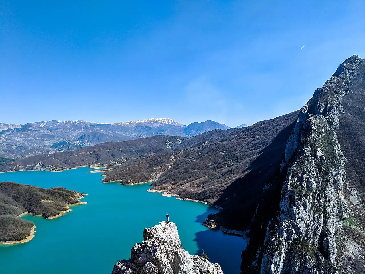
Most people don’t come for a lakeside stroll. They come for the Ballkoni (balcony) viewpoint on the Gamti side - the metal platform and rocky ledge that look straight down the canyon. From the parking and restaurant cluster near the dam, the path climbs steeply on rock and loose gravel. Visitor times vary wildly: some fit walkers reach the main ledge in 15-20 minutes; others need 45-60 minutes up, depending where they park and how often they stop for photos. Plan on 1.5-2.5 hours round trip with breathing room.
Expect exposed steps bolted into the rock, short eroded stretches, and a real drop beside you. It’s a short mountain walk, not a city promenade. Wear shoes with grip. Skip it in a storm or with anyone who freezes on cliff stairs. A small cash fee is sometimes collected for the path - traveller reports float around 100 ALL, but there’s no clean operator tariff page, so confirm on the spot and bring lek notes.
The reward is the photo everyone actually wants: the reservoir as a turquoise ribbon between grey cliffs, with Tirana’s plain somewhere beyond on a clear day. Stay for the light. Midday flattens the colour; early morning or late afternoon makes the water look almost unreal.
Getting there from Tirana
There’s no public bus to the dam or the Gamti trailhead. You either self-drive, negotiate a taxi that will finish the gravel, or join a half-day tour that handles both the road and the hike.
Door-to-viewpoint usually lands somewhere between 45 and 90 minutes from central Tirana. The municipality’s “15 km” figure is straight-line-ish proximity; the clock is dominated by the rough finish, not the asphalt out of town. Follow signs and GPS toward Zall-Herr / Bovilla Dam / Bovilla Restaurant - searching only “Lake Bovilla” sometimes drops people on the wrong approach.
Guided trips from Tirana (hotel pickup, vehicle, guided climb) are sold through ticket platforms rather than by a named operator with a published tariff, so there is no fare to quote here. What we could actually read on 1 September 2026 was one platform’s own inventory, and the spread was wide: the cheapest Tirana minivan departure sat near USD 30 per person and the same page ran up past USD 60 for other products - so treat any single figure you see in search results as one listing on one day, not a price. These are also six-hour days, not half-days, whatever the listing calls them. Confirm the live price when you book, and check whether lunch is included (often it isn’t).
The road is half the story
The approach starts on normal paved streets through the Kamëz side of Greater Tirana, then deteriorates. Traveller reports consistently describe a gravel and dirt finish of roughly the last 6-8 km (some write 8-10). Potholes, dust, oncoming traffic on a narrow track, and soft edges are the usual complaints. After rain the same stretch turns sticky and rutted.
Do not assume a low rental sedan will finish it. High-clearance or a light 4×4 is the comfortable choice. Plenty of visitors in ordinary cars still complete the road on dry days by going very slowly - that is not the same as a guarantee, and rental contracts often exclude damage on unpaved mountain tracks. Read the fine print before you leave Tirana. If you’re unsure, book the tour and let someone else’s van take the hits.
Taxis from the city may refuse the last kilometres or quote a premium for the dirt. Agree the full route and the waiting time before you leave, and pay in cash if that’s what the driver asks for.
Bovilla vs Dajti cable car
People mix these up because both sit on the same mountain massif. They’re different days.
The Dajti Ekspres cable car lifts you from Tirana’s eastern edge onto a ridge plateau in about 15 minutes, with restaurants, meadows and marked walks. From the Tujanit side you can glimpse Bovilla as a distant turquoise slash - no gravel ordeal, but also no balcony hanging over the canyon. Bovilla itself is the drive-and-hike version: harder logistics, closer to the water, and the classic canyon frame.
If you’ve already ridden Dajti and still want the Instagram ledge, plan Bovilla separately. If you only have one free afternoon and hate rough roads, stay with the cable car and save Bovilla for a tour day.
For a wider menu of half-days out of the capital, see the day trips out of Tirana list, which already flags Bovilla as the nature option that needs wheels. Inside the city, the Tirana city highlights page covers the square, bunkers and cable-car logistics before you bolt for the hills.
Timing, kit and honest expectations
Best window: spring and autumn for cool hiking air; summer works if you start early - the trail cooks by late morning. Winter can be clear and beautiful, but frost on rock steps turns the balcony nasty.
Bring: water, sun protection, cash in lek, and shoes you’d trust on scree. There’s usually a restaurant near the dam for coffee and lunch once you’re down, but don’t rely on it for the climb.
Crowds: weekends and mid-morning tour vans fill the parking pocket. Early starts beat both heat and queues for the ledge photos.
Climbing: the municipality notes agencies that run rock routes around the canyon walls. That’s a different sport with its own gear and guides - this page is about the viewpoint walk.
What it’s not: a swimming day, a family pushchair outing, or a “quick 20-minute look” if you’re still negotiating the gravel. Budget a half day and you’ll enjoy it. Rush it and you’ll remember only the potholes.
Who should book a tour, who should drive
Book a guided half-day when you don’t want to risk a rental car on gravel, you’re travelling alone and prefer company on the cliff path, or you’d rather someone else know which GPS pin is the right trailhead. Whether it beats a round-trip taxi depends entirely on which listing you land on and how many of you split the fare - the platform spread we read spanned roughly USD 30 to 60 per person, so run both numbers for your own group rather than assuming the tour is cheaper.
Self-drive when you already have a suitable vehicle, you’re combining Bovilla with other stops on your own clock, and you’re happy to turn around if the last kilometres look worse than your clearance. Park near the dam or restaurant cluster, lock valuables out of sight, and start the climb before the sun is high.
The fail case is simple: treat Bovilla like a swimming lake or assume a low sedan will shrug off the gravel. Get the working-reservoir rule, the balcony climb, and the rough access right, and the morning pays for itself.
Photos
On the map
The map loads on click - to keep the page lightweight.
The map didn’t load. Check your connection and refresh the page.
Admission and opening hours
Open landscape around the dam and Gamti path; swimming in the reservoir is forbidden (drinking water). A small cash fee is sometimes collected for the viewpoint trail - confirm on site. No official published tariff found as of 2026-09-01.
Details checked: September 1, 2026
Distance ≈20 km · roughly 45-90 min depending on the gravel section
- Tirana ≈20 km · roughly 45-90 min depending on the gravel section No public bus to the dam. Paved approach via the Kamëz / Zall-Herr side, then a rough gravel finish. High-clearance preferred; do not assume a low sedan will cope after rain.
Read also

What to see · 11 min read
Valbona Valley: Guesthouses, Walks & Alpine Road
Updated · August 30, 2026Valbona Valley in the Albanian Alps: arrival via Fierza and Bajram Curri, guesthouses, short walks, and the paved Alpine road.

What to see · 9 min read
Shala River Day Trip: Albania's Alpine 'Thailand'
Updated · August 27, 2026Shala River day trip in 2026: turquoise water in the Albanian Alps, boat times from Koman Lake, prices, what to pack, and how it differs from the ferry.

What to see · 9 min read
Saranda Boat Trips 2026: Kakome, Krorez & Mirror Beach
Updated · August 25, 2026Boat trips from Saranda reach Kakome, Krorez and Mirror Beach by sea - adult fares about EUR 35-41 north, from EUR 100 south, plus where boats leave.

What to see · 11 min read
Rozafa Castle, Shkoder: Legend, Views and How to Visit
Updated · August 24, 2026Rozafa Castle in Shkodra: 2026 summer hours until 20:00, tickets at the gate, the legend as folklore, and the view over the lake and rivers.