10 Days in Albania: Ultimate Road Trip Itinerary
A self-drive Albania road trip: Tirana, Berat, the Riviera, Saranda, Ksamil and Gjirokastër - with distances, stops, where to stay and tips.
This is the classic Albania road trip: a one-week-plus loop south from Tirana through Berat, over the Llogara Pass to the Albanian Riviera, down to Saranda and Ksamil, and back up through Gjirokastër. It is best done with your own car - distances are short but the coastal and mountain roads are slow and scenic, and a rental frees you from sparse rural bus timetables. Plan on 8 days to do it without rushing (6 if you’re quick, 10 if you linger on the beaches), covering roughly 600-650 km in total.
Below is a day-by-day plan with what to see at each stop, where to sleep, and the driving times between them. All distances and times are road estimates - mountain and coast roads in the south are slower than the kilometres suggest, so always pad your timings.
Why drive Albania (and how this loop works)
Albania rewards a car more than almost any country in the Balkans. The headline sights - inland UNESCO towns, a wild Ionian coastline, an archaeological park near the Greek border - sit in a rough triangle that public transport stitches together only awkwardly. With your own wheels you can cross the Llogara Pass in golden light, stop at a Riviera cove that has no bus stop, and swing inland to the stone city of Gjirokastër on the way home.
The loop here is built as a circle so you end where you started - handy if you fly in and out of Tirana and return the car there. If you’re short on time, you can cut it to a one-way Tirana-to-Saranda run and hand the car back in the south, but a round trip via Gjirokastër is the better experience. Before you book, read our full guide to renting a car in Albania for costs, insurance and the local driving quirks.
Day 1-2: Tirana
Start in the capital, where you’ll most likely land and pick up the car. Give Tirana a day before you drive: it’s a young, colourful city built around Skanderbeg Square, with the painted apartment blocks of the Blloku district, the recently reopened Pyramid of Tirana and the cable car up Mount Dajti for a view over the whole valley. It’s also your last easy chance to stock up before the smaller towns south.
A practical first move is to collect the rental car on your second morning rather than day one - you don’t want a car sitting in a paid city garage while you walk a compact, walkable centre. For the full rundown of sights, neighbourhoods and food, see our guide to the best things to do in Tirana.
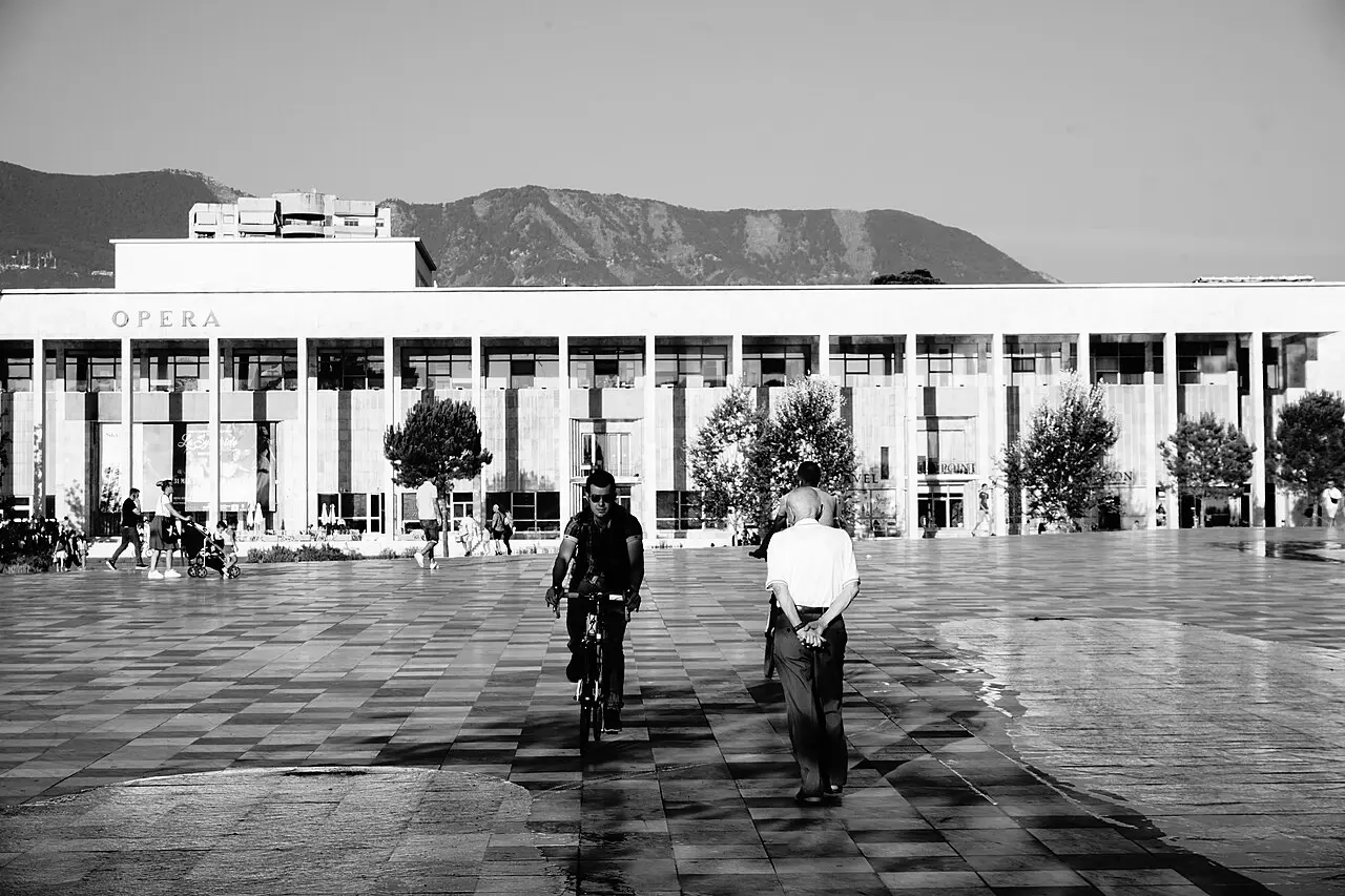
Where to stay: central Tirana, around Blloku or the New Bazaar (Pazari i Ri), puts you in walking distance of the restaurants and bars.
Day 3: Berat - the city of a thousand windows
From Tirana it’s about 120 km / 2-2.5 hours south to Berat, the UNESCO World Heritage town whose tiers of white Ottoman houses, each with rows of wide windows, climb two facing hillsides above the Osum river. Walk the cobbled Mangalem and Gorica quarters, cross the old stone bridge, and climb up to the Kala - a castle that is still a lived-in neighbourhood, with churches and the Onufri icon museum inside its walls.
Berat is an easy half-day of sightseeing plus an overnight; with more time you can add the Osum canyon or a wine tasting in the surrounding hills. Our Berat travel guide covers the sights, day trips and where to stay in detail.
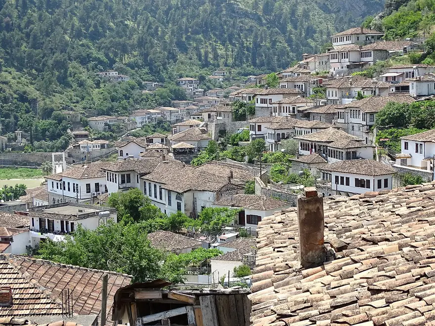
Driving note: the Berat road is straightforward two-lane highway. There’s no train; if you weren’t driving you’d be on a bus or furgon.
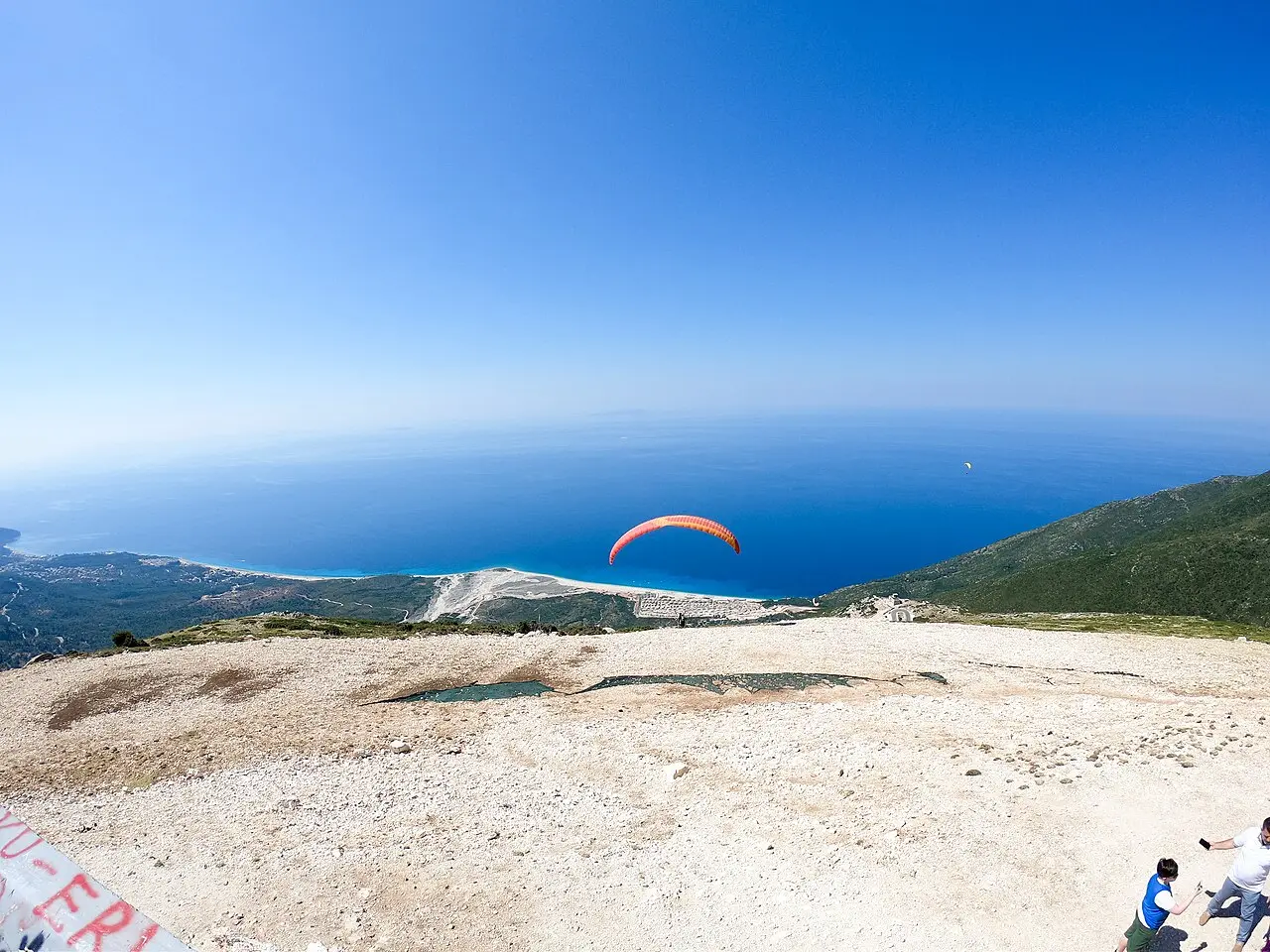
Day 4: Vlora, the Llogara Pass & the Riviera
This is the day the drive earns its reputation. Head west to Vlora (roughly 130 km / 2-2.5 hours from Berat), the gateway where the coastal road south begins. From Vlora the road climbs the Llogara Pass - a switchbacking ascent to around 1,000 m through a national park, with a viewing platform where the whole Albanian Riviera suddenly opens up below you, the mountains dropping straight into the Ionian.
Over the pass you reach the Riviera proper: Dhërmi, Himara, Gjipe and a string of pebble coves and turquoise water. Plan to drive this stretch slowly and pick a beach village to stop in - many of the best coves have nowhere to park a tour bus, which is exactly why the car pays off here.
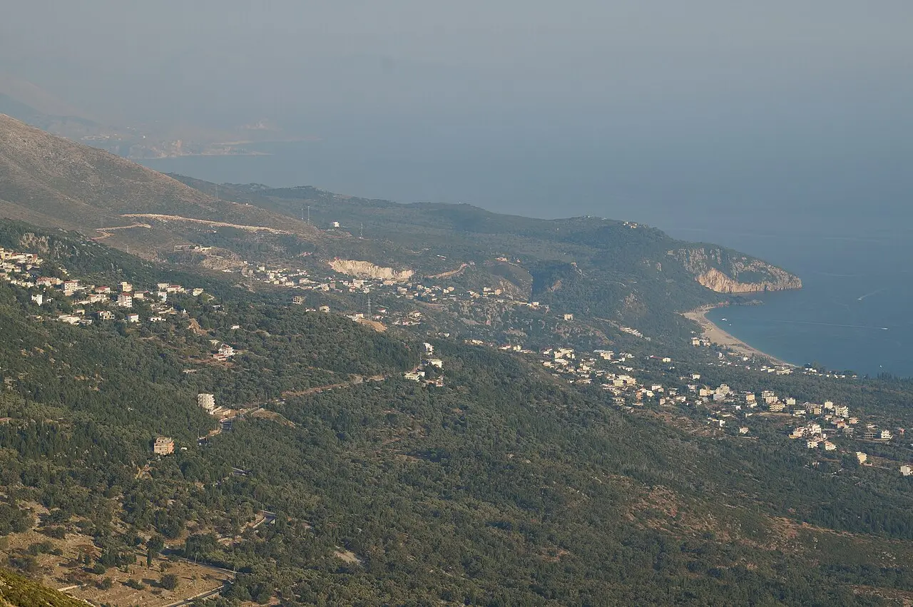
Where to stay: Dhërmi or Himara make a good Riviera base for the night, breaking the drive between Vlora and Saranda.
Driving note: the Llogara switchbacks are steep and can be busy in peak summer; drive them in daylight and don’t rush. The Llogara Tunnel - a roughly 6 km tunnel under the pass - opened in July 2024 and speeds this section up: it was toll-free through 2025, with a toll of about 250 ALL (around EUR 2.50) one way from April 2026 (check the current rate). The old pass road stays open too, and for the view it’s still worth taking at least one way.
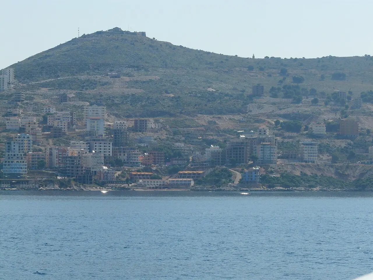
Day 5: Saranda
Continue down the coast to Saranda (about 130 km / 3-3.5 hours from the central Riviera, with stops). The biggest town on the southern coast, Saranda is the practical hub for the far south: a long seafront promenade, ferries to Corfu, and easy access to the Butrint archaeological park, the Blue Eye spring and the sunset view from Lekursi Castle on the hill above town.
Base here for two nights so you can fit in Butrint and the Blue Eye without a rushed beach day. The full breakdown of beaches, day trips and logistics is in our Saranda travel guide.
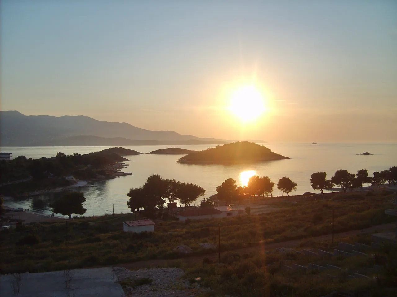
Day 6: Ksamil
Just 20 minutes / ~17 km south of Saranda, Ksamil is the postcard end of the Riviera: shallow turquoise bays and a cluster of tiny offshore islands close enough to swim or paddle out to. It’s the busiest beach scene in Albania in July and August, so come early for a spot. Many travellers stay in Saranda and visit Ksamil as a day trip, or base directly in Ksamil for the beaches.
Combine the morning at Ksamil’s beaches with an afternoon at nearby Butrint, which sits on the same peninsula just south - see our Butrint National Park guide for the ruins and visiting tips.
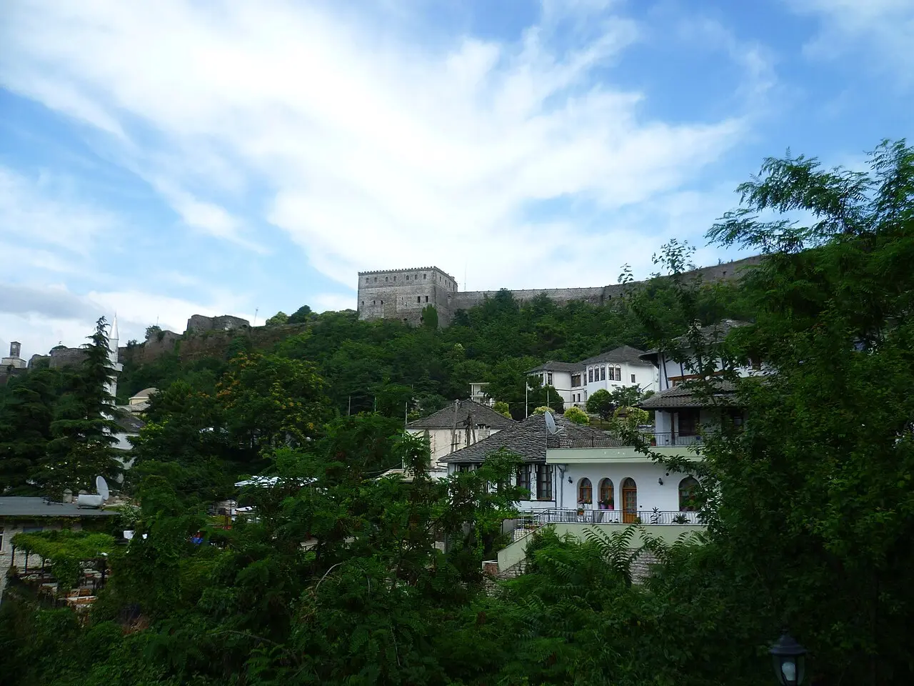
Day 7: Gjirokastër - the stone city
Turn inland for the last major stop: Gjirokastër, about 120 km / 2-2.5 hours north-east of Saranda. The “stone city” is a UNESCO town of grey slate-roofed Ottoman houses climbing a steep hillside under an enormous castle that holds a weapons museum and wide views over the Drino valley. Wander the old bazaar, visit a restored Ottoman tower-house, and try the local qifqi (rice-and-egg balls).
It’s an easy overnight, and a fitting last stop before the drive back to Tirana.
Day 8: Drive back to Tirana
From Gjirokastër it’s roughly 230 km / 3.5-4 hours back to Tirana via the inland highway, closing the loop and returning the car. If you have an extra half-day, you can break the drive with a stop near Fier (the ancient ruins of Apollonia) or simply build in buffer time for the return and your flight.
Distances at a glance
| Leg | Roughly | Drive time |
|---|---|---|
| Tirana → Berat | ~120 km | 2-2.5 h |
| Berat → Vlora | ~130 km | 2-2.5 h |
| Vlora → Saranda (via Llogara & Riviera) | ~130 km | 3-3.5 h |
| Saranda → Ksamil | ~17 km | 20 min |
| Saranda → Gjirokastër | ~120 km | 2-2.5 h |
| Gjirokastër → Tirana | ~230 km | 3.5-4 h |
Total driving is around 600-650 km over the loop - short distances, but slow, scenic roads, so don’t pack the days too tightly.
Practical tips for the drive
A few things worth knowing before you set off:
- Car rental. Book ahead in summer; a small car is fine, but check insurance and excess carefully. Full details are in our car rental guide.
- When to go. The Riviera season runs roughly May to October; July-August are hottest and busiest, while late May-June and September-October give you warm sea, open roads and far fewer crowds. See our guide to the best time to visit Albania.
- Roads. Main highways are good; coastal and mountain sections (especially Llogara) are slow and winding. Drive the passes in daylight, watch for livestock on rural roads, and fuel up before remote stretches.
- Money. The currency is the Albanian lek (ALL); carry cash for small guesthouses, parking and beach cafés, though cards work in larger hotels and restaurants.
- Insurance. Make sure you’re covered for both driving and travel - read whether you need travel insurance for Albania before you go.
What’s nearby and read also
- Browse all our Albania road trips and routes for more itineraries.
- Starting point: the best things to do in Tirana.
- Inland UNESCO stop: the Berat travel guide.
- The southern hub: our Saranda travel guide.
- Getting the car sorted: how to rent a car in Albania.
Route day by day
- Days on the road
- 8
- Distance
- ≈620 km
- Budget from
- 60 EUR
- Best season
- May, June, September, October
-
Tirana
Route startstop ≈2880 min
Pick up your rental car and start in the capital - Skanderbeg Square, the Pyramid and Mount Dajti.
Photo: Andrew Milligan sumo / Wikimedia Commons, CC BY 2.0 -
Berat
120 km from the startstop ≈1440 min
The UNESCO "city of a thousand windows" - castle, Mangalem and Gorica quarters, Osum canyon.
Photo: Adam Jones / Wikimedia Commons, CC BY-SA 2.0; sourceUrl: https://commons.wikimedia.org/wiki/File:View_over_Mangalem_District_-_Berat_-_Albania_(40710158650).jpg -
Vlora & the Riviera
250 km from the startstop ≈1440 min
Cross the Llogara Pass for the Ionian coast - Dhërmi, Himara and the turquoise Riviera beaches.
Photo: Albinfo / Wikimedia Commons, CC BY-SA 4.0 -
Saranda
380 km from the startstop ≈1440 min
Riviera hub for Butrint, the Blue Eye spring and Lekursi Castle sunsets.
Photo: Piotrus / Wikimedia Commons, CC BY-SA 3.0 -
Ksamil
400 km from the startstop ≈1440 min
Albania's most famous beaches and the little offshore islands you can swim out to.
Photo: Q.marjola / Wikimedia Commons, CC BY-SA 3.0 -
Gjirokastër
460 km from the startstop ≈1440 min
The UNESCO "stone city" of slate-roofed houses, a vast castle and the old bazaar - last stop before the loop back to Tirana.
Photo: Radosław Botev / Wikimedia Commons, CC BY-SA 4.0
Route map
The map with stops loads on click - to keep the page lightweight.
The map didn’t load. Check your connection and refresh the page.