Southern Albania Road Trip: Riviera, Gjirokaster & the South
A southern Albania road trip: a self-drive loop from Saranda through Ksamil, Butrint, the Blue Eye, Gjirokaster and the wild Vjosa valley, with distances.
Southern Albania is the half of the country that pairs a turquoise coast with genuinely wild interior, and this loop is built to see both in one drive: it runs from Saranda down to Ksamil and Butrint, inland to the Blue Eye and Gjirokaster, deep into the Vjosa valley at Permet, and back to the coast at Himara. It’s roughly 340 km and best given 5 to 7 days. A car is close to essential - the inland south in particular is stitched together by slow mountain roads that buses barely serve.
What sets this apart from the country’s other big drives is the inland leg. This is a south-only trip, so it skips Tirana and Berat entirely: for the full national circuit see our Albania road trip itinerary, and if you only want the beaches, the Albanian Riviera road trip covers the coast on its own. For the UNESCO Berat-Gjirokaster-Butrint corridor instead of Riviera beaches and Vjosa, take the UNESCO Albania route. The reason to choose this one is Permet, the Vjosa and the Benje thermal baths - a stretch of Europe’s last wild river that the coast-and-castles crowd drives straight past.
Why you want a car (and where to start)
The far-south coast has buses and furgons, and you could just about reach Saranda, Gjirokaster and even Permet on public transport with patience. But the whole point of the interior - a thermal pool under an Ottoman bridge, a stone village up a valley with no timetable, the Blue Eye on the way between two towns - is the freedom to stop. With your own car you drive the Llogara coast in good light and detour up the Vjosa without watching the clock. Before you book, our guide to renting a car in Albania covers costs, insurance and the local driving quirks.
Most people start in Saranda, either off the Corfu ferry (a 30-to-90-minute crossing, so the south is easy to reach from Greece) or after driving down from Tirana - if you’re joining the loop from the capital without a car yet, Tirana to Gjirokaster covers the coach options into the stone city. You can run the loop in either direction; described here it goes down to the far south first, turns inland, then comes back along the coast. If you’re weighing this against a shorter or longer trip, our guide to how many days you need in Albania lays out the options.
Saranda: the southern base
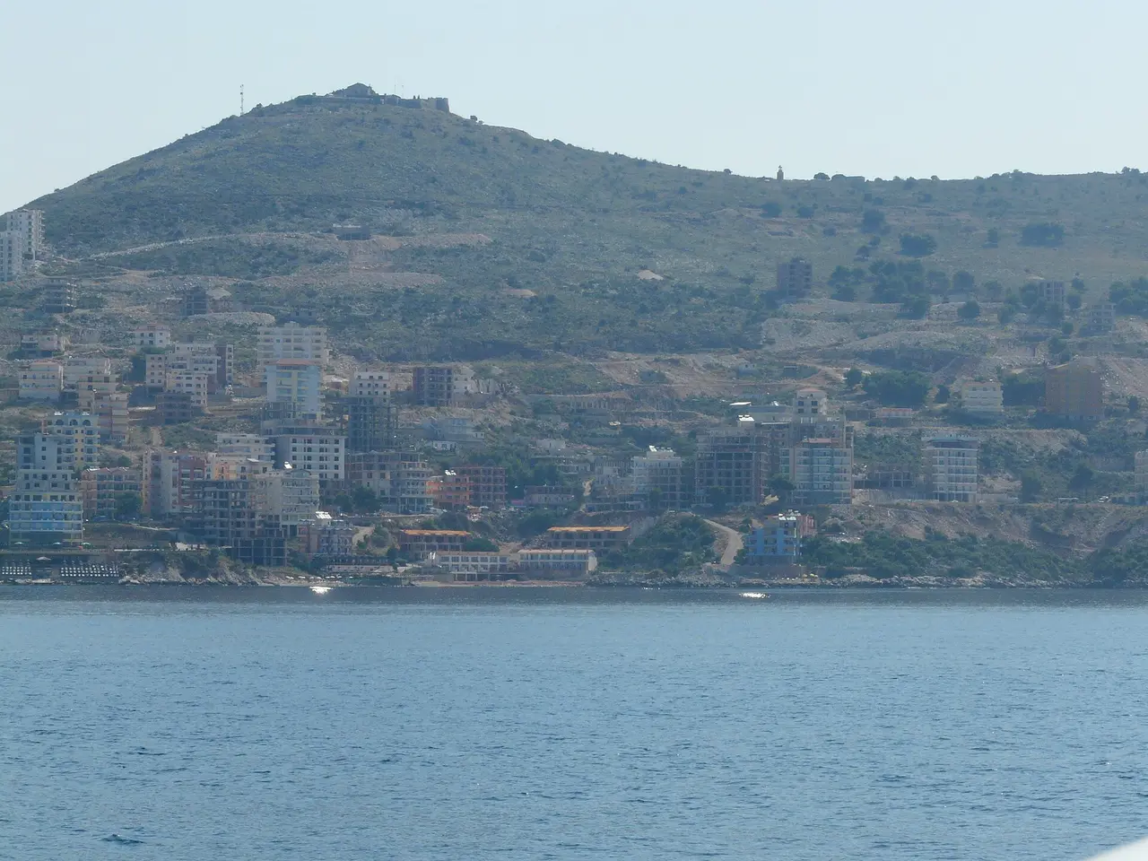
Saranda is the biggest town on the southern coast and the natural hub for the far south - a long seafront promenade, ferries to Corfu, and a spread of hotels to sleep in before you strike out. It’s a working resort town rather than a pretty one, but the setting is fine and the Lekursi Castle sunset over the bay, with dinner at the hilltop restaurant, is worth timing your first evening around. Give it a night, and use it to stock up on cash and fuel. The full breakdown of beaches and logistics is in our Saranda travel guide.
Ksamil and Butrint: the far-south tip
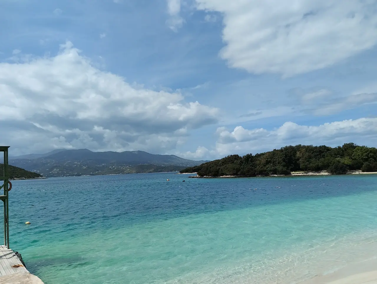
Twenty minutes south of Saranda, Ksamil is the postcard end of the coast: shallow, clear bays and a cluster of tiny offshore islands you can swim or paddle out to. It’s also the busiest beach scene in Albania in July and August, so come early for a spot, or visit in the shoulder season when the water is still warm and the sunbeds aren’t stacked three deep.
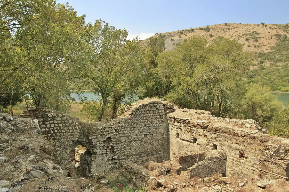
On the same peninsula just south sits Butrint, an ancient city layered through Greek, Roman, Byzantine and Venetian hands and now a national park in a beautiful lagoon setting. Its theatre, baptistery mosaics and walls are the best classical ruins in the country - give it a couple of hours in the morning before the heat. Our Butrint National Park guide covers the ruins and visiting tips.
The Blue Eye: the turn inland
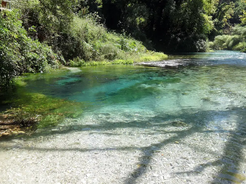
Leaving the coast, the road toward Gjirokaster passes the Blue Eye (Syri i Kaltër), a karst spring about 22 km / 30-40 minutes from Saranda where water wells up from a deep vent in shades of blue and green you have to see to believe. Entry is a token 50 lek and parking around 200 lek, both cash; in July and August the small car park fills, sometimes completely, so come early or late. You can’t swim in the spring itself, but it’s a short, worthwhile stop that marks the shift from beaches to mountains.
Gjirokaster: the stone city
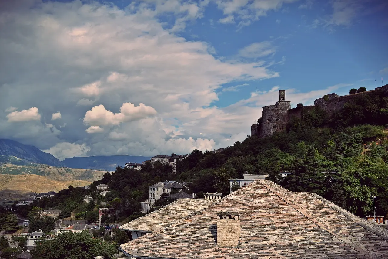
Gjirokaster is the inland anchor of the south and one of Albania’s two UNESCO towns - a “stone city” of grey slate-roofed Ottoman houses climbing a steep hillside under an enormous castle. Wander the cobbled old bazaar, tour a restored tower-house, climb up to the fortress and its weapons museum for the view over the Drino valley, and try the local qifqi (fried rice-and-egg balls) that you’ll not find much elsewhere. It earns an overnight; the town is at its best in the evening once the day-trippers leave. Our Gjirokaster travel guide has the detail.
Permet, the Vjosa and the Benje thermal baths
This is the leg that makes the trip different, and the one most itineraries miss. From Gjirokaster it’s about 65 km / 1.5 hours north-east to Permet, a small, green town on the banks of the Vjosa - one of the last wild, free-flowing rivers in Europe, protected since March 2023 as the Vjosa Wild River National Park, the first of its kind on the continent. The town is the gateway to the valley and an easy, friendly place to base for a night.
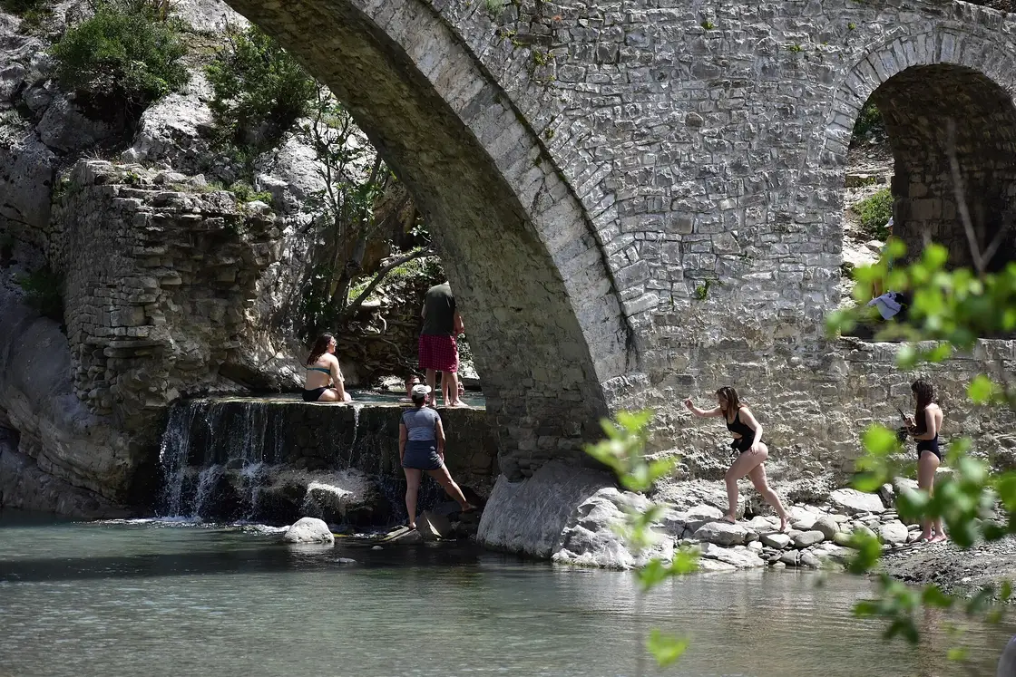
The highlight is the Benje thermal baths (Banjat e Benjes), about 14 km / 20-25 minutes south-east of Permet, where a set of natural sulfur pools steam beside the river next to the graceful arched Kadiu Bridge, an Ottoman span over the Lengarica canyon. Bathing is free; the water is warmest and the setting best in the cooler months, when a soak with the cold river running past is the whole point. Bring water shoes and cash for the small car park, and don’t expect changing rooms. One caveat for 2026: the site is being rebuilt with public money, works are due to finish in September, and basins have been found drained more than once during the season, so check before you commit to the detour. The full picture, including what’s free, what’s missing and what the works have done to the water, is in our Benja thermal baths guide.
With more time, the Zagoria valley - a nature park of traditional stone villages and old caravan trails between Gjirokaster and Permet - is one of the most atmospheric detours in the country, though its roads are rough and best tackled with care or a local guide. Even without it, the run up the Vjosa is the part of this drive you’ll remember.
Himara and the coast home
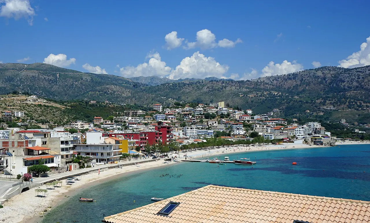
To close the loop, drive back down the Vjosa and over to the coast via Tepelena and Borsh, rejoining the Riviera at Himara (roughly 130 km from Permet, a slow 2.5 to 3 hours). Himara is the most balanced town on the Riviera - real restaurants, a working harbour, town beaches and a scatter of satellite coves within fifteen minutes - and it makes a relaxed last night before the short run back down to Saranda (about 70 km). If you’ve got a spare afternoon, the long quiet beach at Borsh is a good leg-stretch on the way.
Distances at a glance
| Leg | Roughly | Drive time |
|---|---|---|
| Saranda -> Ksamil & Butrint | ~20 km | 25 min |
| Ksamil -> Blue Eye | ~30 km | 40 min |
| Blue Eye -> Gjirokaster | ~30 km | 40 min |
| Gjirokaster -> Permet | ~65 km | 1.5 h |
| Permet -> Himara (via Tepelena) | ~130 km | 2.5-3 h |
| Himara -> Saranda | ~70 km | 1.5 h |
| Loop total | ~340 km | ~7-8 h driving |
That total is moving time only; with the baths, the beaches, the ruins and the stone towns, this is comfortably a five- to seven-day trip, not a long weekend.
When to go and practical tips
- Best months. Late May-June and September-October are the sweet spot: warm sea on the coast, cooler air inland, and the Benje pools at their best. July and August are hot, and Ksamil and Saranda get very busy. See our guide to the best time to visit Albania.
- Carry cash in lek. The Blue Eye, beach parking, the Benje car park and small guesthouses are cash-only; cards work in bigger hotels and restaurants.
- Roads. Main roads to Gjirokaster and Permet are good; the coast and the Tepelena-to-Borsh stretch are slow and winding. Drive them in daylight and pad every estimate.
- Book beds ahead in peak. Saranda, Ksamil and Himara fill up in July and August - reserve before you drive.
- Pack for both. You want swimwear and water shoes for the coast and the baths, and a warm layer for evenings in Gjirokaster and up the Vjosa.
Read also
- The coast on its own: the Albanian Riviera road trip.
- The whole country: the Albania road trip itinerary.
- More routes: browse all our Albania road trips.
- The southern hub: our Saranda travel guide.
- Getting the car sorted: how to rent a car in Albania.
Route day by day
- Days on the road
- 6
- Distance
- ≈340 km
- Budget from
- 55 EUR
- Best season
- May, June, September, October
The route at a glance
-
Saranda
Route startstop ≈1440 min
The southern hub and natural start - most people arrive by the Corfu ferry or drive down from Tirana. Seafront promenade and the Lekursi Castle sunset.
Photo: Piotrus / Wikimedia Commons, CC BY-SA 3.0 ( source) -
Ksamil & Butrint
20 km from the startstop ≈480 min
The far-south tip: the shallow turquoise bays and little islands of Ksamil, and the ancient city of Butrint on its wooded peninsula.
Photo: Marcin Konsek / Wikimedia Commons, CC BY-SA 4.0 ( source) -
The Blue Eye
45 km from the startstop ≈120 min
A karst spring of impossibly clear blue-green water on the road inland - the turn from the coast toward the mountains.
Photo: Krzysztof Dudzik-Górnicki / Wikimedia Commons, CC BY-SA 3.0 ( source) -
Gjirokaster
75 km from the startstop ≈1440 min
The UNESCO stone city - slate-roofed Ottoman houses under a vast castle, an old bazaar and the local qifqi rice balls.
Photo: ViolaCiv / Wikimedia Commons, CC BY-SA 4.0 ( source) -
Permet & Benje
140 km from the startstop ≈1440 min
The deep inland south: Permet, gateway to the Vjosa Wild River National Park, and the Benje thermal baths under an Ottoman bridge.
Photo: Nensi Bibe / Wikimedia Commons, CC BY-SA 4.0 ( source) -
Himara
270 km from the startstop ≈1440 min
Back to the coast on the southern Riviera - the most balanced beach town, and a last swim before the loop closes at Saranda.
Photo: Albinfo / Wikimedia Commons, CC BY-SA 4.0 ( source)
Route map
The map with stops loads on click - to keep the page lightweight.
The map didn’t load. Check your connection and refresh the page.